Challenges
- A US company wanted to find features on satellite and drone images.
- The company asked Xpertnest to design software to run an algorithm that could automatically stitch multiple images on a grid.
Xpertnest’s Solutions
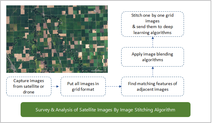
- Xpertnest created software to find correlations between adjacent images, and match and blend features.
- Adjusted the blended images for exposure and border smoothening.
- Made the stitched images available for deep learning algorithms in post processing.

Capture images from satellite or drone
Enter all images into a grid format
Match features of adjacent images
Apply image blending algorithms
Stitch individual images together and send them to Deep Learning algorithms
Survey and Analyse Satellite Images Using an Image Stitching Algorithm
Value Delivered
- Improved the efficiency of image analysis and saved time.
- Enabled manual land mapping and analysis in one place

